Melbourne bike map
You can find on this page the Melbourne bike map to print and to download in PDF. The Melbourne bicycle map presents the bike routes and lanes of Melbourne in Victoria - Australia.
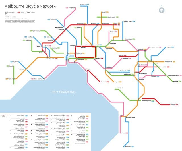
Melbourne bike lane map
The Melbourne bike lane map shows all the bike routes of Melbourne. This bicycles lanes map of Melbourne will allow you to easily plan your routes with a bike in Melbourne in Victoria - Australia. The Melbourne bike lanes map is downloadable in PDF, printable and free.
The City of Melbourne TravelSmart map provides a comprehensive guide to on-road and off-road biking routes and facilities in the City of Melbourne. Major on-road cycling routes include Royal Parade, Canning Street, Rathdowne Street, Swanston Street, Albert Street, La Trobe Street, Exhibition Street and St Kilda Road as its shown in Melbourne bike lane map. Off-road routes include the Yarra River Trail, Moonee Ponds Creek Trail, Maribyrnong River Trail, Dynon Road, Footscray Road and Harbour Esplanade.